Historylinks Heritage Trail
EXPLORE DAZZLING DORNOCH THROUGH THE AGES
Welcome to Dornoch! We hope you enjoy its unique heritage to the full. You can explore the town by walking around with an eye open for detail; a street name here, and architectural detail there, all add up to give a fascinating picture of our past. Dornoch is unusual in that so much of our heritage is accessible, and to make your stay in Dornoch more entertaining and informative, we invite you to follow our Historylinks Trail. With an interpretation board at every stop, you can begin your journey at Historylinks Museum and discover the places and people that have shaped Dornoch over hundreds of years.
On your journey, be responsible and respectful of local communities and wildlife and follow the Scottish Outdoor Access Code.
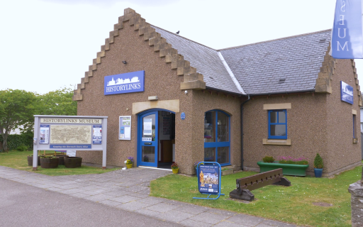
 Historylinks Museum at Dornoch, Sutherland
Image provided by Lynne Mahoney
HISTORYLINKS MUSEUM
Welcome to the starting point for the trail, with lots more comprehensive information available in the Historylinks Museum (entry fee applies).
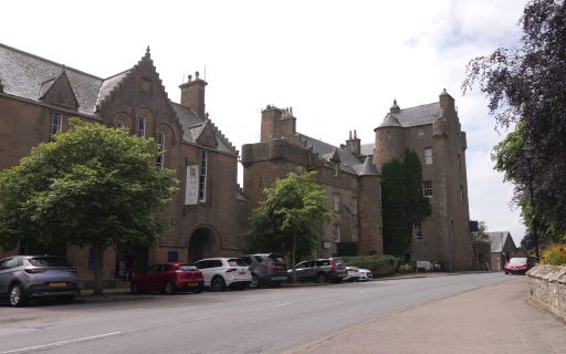
Spend a few moments looking at the map on your right. The town it portrays has been shaped by over a thousand years of history. Our oldest building is Dornoch Cathedral. Work on the Cathedral began in 1224 and it is one of the original reasons for Dornoch’s importance. Most of the other buildings you see on the map – with the exception of Dornoch Castle – date from the 19th and 20th centuries.
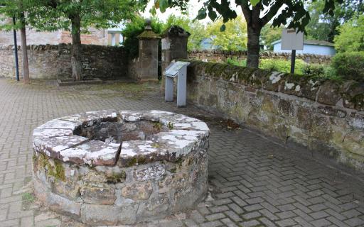
OLD PARISH MANSE
The old parish manse (or the house of the local churchman) once stood behind this wall and over to your right. It was a fine stone building and was probably one of the town’s larger houses when it was built in the 17th century.
Take a closer look at this well. Without it life would have been very difficult for the minister’s family and household. For centuries, wells like this provided all the town’s drinking and washing water. There were four public wells and a few private ones, like this one.
 The Old Manse Well at The Meadows, Dornoch
Image provided by Lynne Mahoney
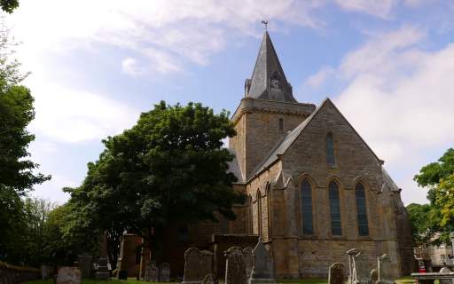
 Dornoch Cathedral, Sutherland
Image provided by Lynne Mahoney
CATHEDRAL GARDENS
Dornoch Cathedral has been in almost continual use for nearly eight centuries. It was built by Gilbert de Moravia who later became known as Bishop or Saint Gilbert. Gilbert’s stonemasons first erected four huge pillars. Each pillar was over a metre thick and 8 metres high. On the top of these they built two great stone arches, 14 metres high. If you go inside the Cathedral you can still see Gilbert’s pillars, eight centuries after they were first erected. Later he added the cathedral tower and on top of the tower he built a steeple.
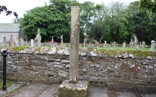
MERCAT CROSS
In medieval Dornoch, the mercat cross marked the place where weekly local markets were held. By the 17th century, up to seven annual county fairs were also taking place here – some lasting for two or three days each. On fair days, the road and churchyard in front of you were covered in merchants’ tents, some pitched right on top of the graves themselves.
In 1628, owning to the success of the markets, Sir Robert Gordon, tutor and guardian to the Earl of Sutherland, persuaded King Charles I to give Dornoch the status of a Royal Burgh.
 Mercat Cross at Dornoch High Street, Sutherland
Image provided by Lynne Mahoney
 Uncovering history on the corner of High Street and Station Road, Dornoch
Image provided by Lynne Mahoney
THE EARLY CHURCH
Several years before Columba landed on Iona in the 6th century, another Irish missionary, St Finbarr of Caithness and Ulster, sailed from Ireland to Scotland.
St Finbarr is traditionally associated with the arrival of Christianity to this area, and it’s possible that he founded a settlement here in Dornoch around 540 AD.
We don’t know exactly where this settlement was, although in around 1850, workmen found traces of what seemed to be monastic cells or living quarters beneath the Social Club, on School Hill, over on your left.
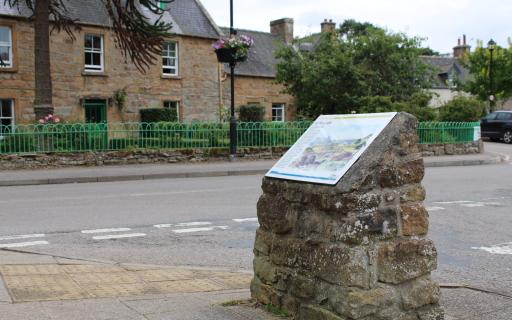
DORNOCH LIGHT RAILWAY
You’re standing beside Dornoch’s railway station which was built in 1902. For nearly 60 years, this station looked after the passengers and freight travelling the branch line to the Mound Station, just seven miles away. Three services a day connected with the Highland Railway’s north-south trains at the Mound, effectively linking Dornoch with the rest of the UK. In front of the station building is the original railway platform, now covered with trees, and in front of that would have been the railway line, now dismantled.
 Dornoch's Former Railway Station, Sutherland
Image provided by Lynne Mahoney
 St. Michael's Well, Dornoch
Image provided by Lynne Mahoney
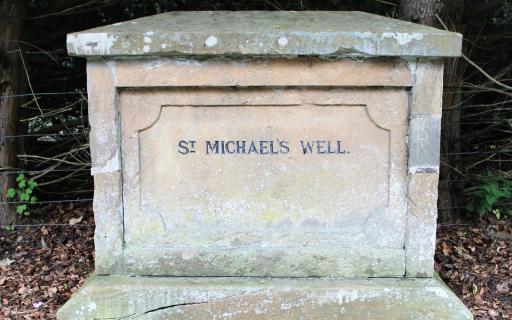
ST. MICHAEL’S WELL
In 1832, a new Parliamentary Reform Act declared that only those resident within 7 miles of the town boundary could vote. George Gunn, a Factor on the Sutherland Estate, lived just outside the town boundary. Instead of moving house to retain his voting rights, George decided to move the boundary. He inscribed this stone and placed it here, even though the real St Michael’s Well was much closer to the town.
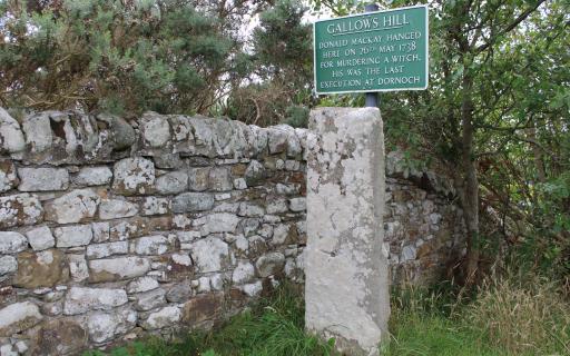
GALLOWS HILL
In 1738 an old woman was found in her home near Golspie, apparently beaten to death with a spade. A young road labourer, Donald Mackay, was arrested and tried for her murder. At his trial he claimed that the old woman was a witch and that, unknown to him, she had disguised herself as a hare. All he had done, he told the court, was to injure a hare with his spade. He was sentenced to death and hanged here on Gallows Hill on 26th May 1738. Donald Mackay’s was the last execution to take place in Dornoch.
 Gallows Hill, Dornoch
Image provided by Lynne Mahoney
 Cholera Stone at Gallows Hill, Dornoch
Image provided by Lynne Mahoney
CHOLERA STONE
We don’t know whether the man buried here died of cholera or not, but the guards who refused to let his body enter the town were absolutely right to be cautious. 6,000 people in Scotland died from cholera in the 1832 outbreak.
Very little was known about the causes of cholera. People believed you could catch it from a foul-smelling vapour, or miasma, like the steamy stench that hangs around manure heaps. Public health officials were paid to rid towns of bad smells – they cleared dung hills, cleaned and whitewashed houses and tied up wandering animals.
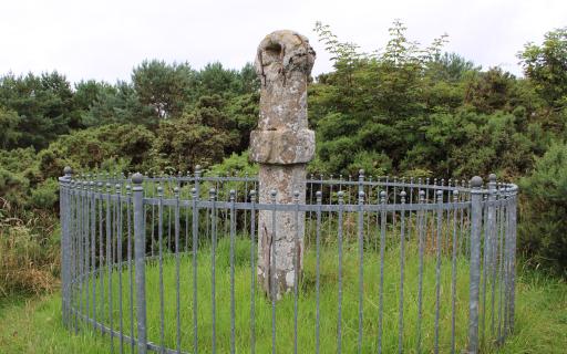
THE EARL’S CROSS
This unusually-shaped stone may have been placed here 800 years ago to mark the boundary between the lands of Gilbert, Bishop of Caithness and those of his cousin, William, the 1st Earl of Sutherland who resided in nearby Golspie. These two men held difficult positions in an unstable area and relied on one another for help. In the 13th century the Dornoch Firth was an explosive frontier between the Scottish Kings and the Norse Earls of Orkney. The Sutherland coastline had been repeatedly raided and settled by Viking ships since the 9th century, and violent attacks were still common.
 The Earl's Cross, Dornoch
Image provided by Lynne Mahoney
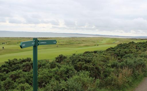
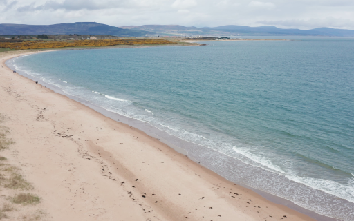
 Dornoch Links, Sutherland
Image provided by Lynne Mahoney
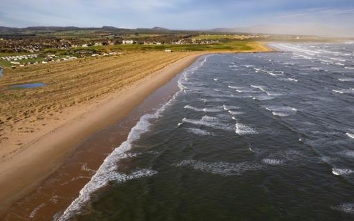
DORNOCH LINKS
10,000 years ago you would have been surrounded by miles of sheet ice.
As the ice melted, the sea rose. It took another 4,000 years for the land to rise back to its present position. Sand, pebbles and shells were left stranded high above the water line all along this coast. Grass soon grew over the sand, forming the links, or raised beach. By the end of the 19th century people were regularly playing golf on the links. Members of the first Dornoch golf club played on a basic nine-hole course with no greens and no fairways.
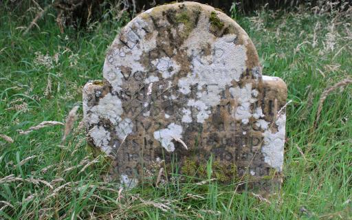
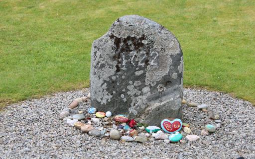
THE WITCH’S STONE
Witch hunts regularly took place across Europe in the 16th and 17th centuries, but they were particularly rigorous in Scotland.
In early 1727 Janet Horne’s neighbours accused her of making a pact with the devil, of changing her daughter into a pony and of having her shod by the devil himself. Mother and daughter were brought to the prison here in Dornoch and tried by Captain David Ross, sheriff-depute of Sutherland. They were found guilty and condemned to be burned the following day.
 The Witch's Stone, Dornoch
Image provided by Lynne Mahoney
 Littletown, Dornoch
Image provided by Lynne Mahoney
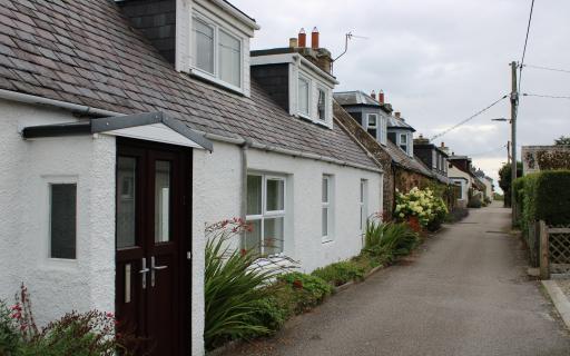
LITTLETOWN
This small hamlet is a quiet reminder of one of the most dramatic periods of social change in Sutherland. The Sutherland Clearances, as this period of evictions became known, was part of a general movement to ‘improve’ and industrialise the Highlands. Landowners, such as the Duke and Duchess of Sutherland, hoped to increase the productivity of their land by replacing their unprofitable tenants with large-scale sheep farmers.
Some of those cleared families found their way to this waste ground near Dornoch and decided to stop. Unable to make a living, many left for North Carolina, America. Littletown is their legacy.
THE RECEIVING HOUSE
After reading the sign, you may want to walk up the hill on your left and stop beside the War Memorial. The memorial is near where Dornoch’s Receiving House once stood. Until 1830, post was carried by relays of runners. The Receiving House was the handover point and the town’s post office. The old Receiving House was taken down at the end of the 19th century and the runners were replaced by faster horse-drawn carriages.
The fine Highland soldier on the War Memorial now gazes over the Dornoch Firth, and forever remembers those who can never return home.
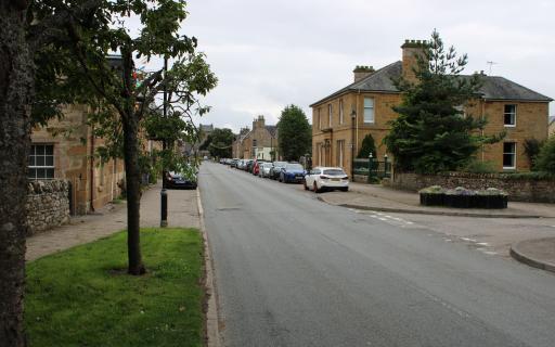
 Looking east on Castle Street, Dornoch
Image provided by Lynne Mahoney
 Dornoch Heritage Trail Map
Image provided by Lynne Mahoney
 Image provided by Lynne Mahoney
Our many thanks extend to Historylinks for putting together this self-guided itinerary.
Historylinks Museum was built in 1997 and founded by members of Dornoch Heritage Society. The museum tells the turbulent story of Dornoch from the earliest times, Viking treachery to Clan warfare, the burning of the last alleged witch in Scotland to the Sutherland Clearances. Step back in time and find out about the Dornoch Light Railway, Royal Dornoch Golf Club and the local fishing industry in Embo.
Enjoyed this itinerary? Why not dive into more of Dornoch's history with the Historylinks Archive!
FOLLOW HISTORYLINKS ON SOCIAL MEDIA
Share this itinerary
| Transport | Walking |
| Duration | Several days |
Destinations on this Itinerary

Stories
Spinningdale Cotton Mill
Learn about the story of the short-lived Spinningdale Cotton Mill on the north-western shores of the Dornoch Firth, Sutherland.
Always by the Sea
Discover one stitcher's journey, stitched beautifully onto a journey stone.
Little Yellow Gem
Explore an artistic journey stone tribute to the wonderful little gem that is buttonweed.
All Along the Strandline, the Picts Kept the View
Discover three artistic tributes to the history of and contemporary Highland shorelines

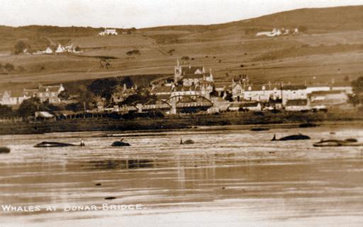
The Wail of the Whale
Recount the tragic stranding of a whale pod in the Dornoch Firth in 1927 with this poem.
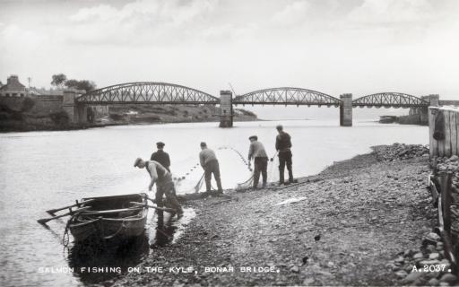
Salmon Stations Around the Easter Ross Peninsula
Journey to the Dornoch and Moray Firths, where the salmon netting stations stretched from near the north Sutor to the Dornoch Firth and Paterson Island near Inver. Discover salmon fishing stories surviving through relatives of those men who worked the sea and the land throughout the year.
Lord Reay and the Working Fairies
Explore this intriguing folk tale featuring the Lord Reay and the working fairies of Gizzen Briggs.